Drone surveying and mapping
3D GIS Data | Photogrammetry
2D-3D georeferenced databases, a must for BIM and industry 4.0
Planning and
Site supervision
Topography
2D | 3D cartography
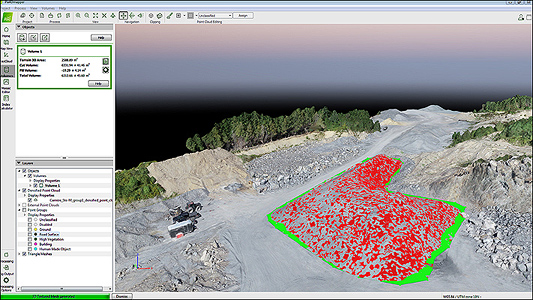
Volumetry
Tonnage
Technical
inspection
STAND. offers innovative services and products in 3D GIS data collection by drone and photogrammetry processing for various industries and sectors of activity.
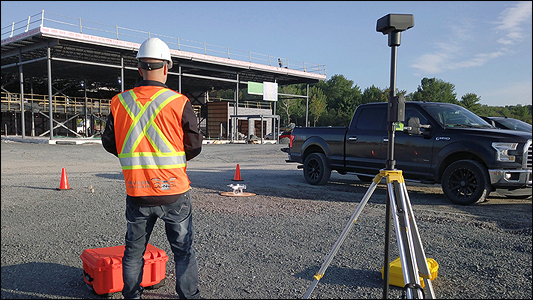
DRONE SURVEYING
PROCESSING
SHARING
Innovate: when versatility rhymes with efficiency
3D coordinate technologies have been used for over a decade. For example, in simulation and modeling in the field of Defense and Aerospace.
The use of Geographic Information System (GIS) has become commonplace in the civil industry. Several sectors such as construction, civil engineering and mining are already integrating 3D GIS data into their operations.
The benefits of using drone surveying and mapping, photogrammetry and 3D GIS data acquisition are many. Drone also excel in accessing difficult views and covering large areas. In addition, the reduction in labor costs makes them key allies in geomatics.
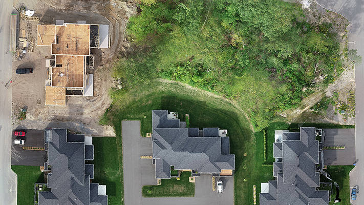
Effective mapping in your projects before, during and after
S.T.A.N.D. now offers a safer, faster and more cost-effective way to streamline your operations. Whether it is to generate a plan, a 3D digital twin, an orthophotography or a point cloud, collecting 3D GIS data by drone allows you to model the sites in order to help you make critical decisions in your commercial activities.
Modeling from 3D GIS data further simplifies the process. In particular, engineers, project managers and superintendents use it in their planning, mobilization and monitoring on large civil or building construction sites. It also allows you to perform volume calculations and share these items with colleagues. In this way, it is possible to compare, analyze and monitor them.
Knowledge and know-how
Innovation in construction and civil engineering inevitably involves the acquisition of 3D GIS data and georeferenced modeling so that large construction sites and public infrastructures benefit from it.
Building Information Modeling (BIM) can be summarized in advanced 3D modeling of buildings. It is a must to enter the era of Industry 4.0. This site monitoring information is useful when it’s time to assess compliance with costs or deadlines.
S.T.A.N.D. puts at your disposal the best technological tools to take a step ahead in your digital transformation. The centimetric precision of georeferenced photos provides an essential 3D model for modeling BIM building data. Thus, the accuracy of your field data will definitely help to galvanize the confidence that your partners have in your project.
Workflow, when you need results
Orthophotography | Orthomosaic
3D modeling | Point cloud
Digital surface model (DSM | DTM)
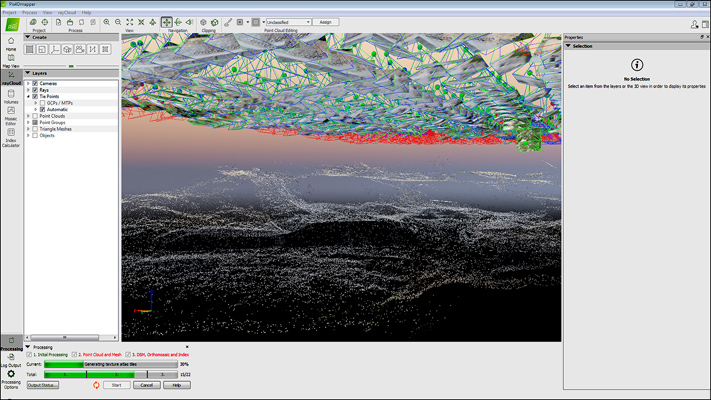
Photogrammetry: overlapping of precision images
Photogrammetry is a technique consisting in 3D GIS data modeling an environment or an object from georeferenced photographs or videos.
In short, this is where the use of drone surveying comes into its own. Indeed, from the air, it is possible to capture a large volume of data in a short time. In addition, this includes the possibility of obtaining complex shots. It also avoids having to enter the same information multiple times. This therefore results in a reduction in additional costs and errors.
The accuracy of 3D GIS data acquisition is critical in order to ensure the fidelity of the models generated. Advanced technologies used by S.T.A.N.D. give you flawless precision drone surveying.
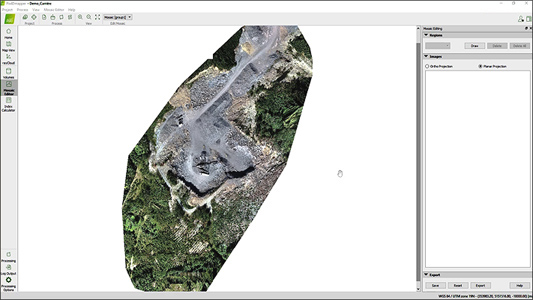
Once reworked with specialized software, 3D models, point clouds and orthophotos can be generated according to your needs.
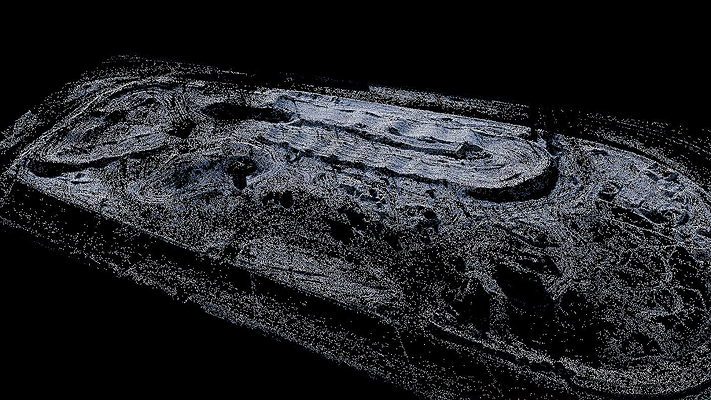
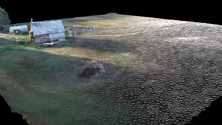
The 3D point cloud, the starting point for your modeling
The color 3D GIS data point clouds in a three-dimensional XYZ coordinate system are generated during photogrammetry processing. They are then used to represent the surfaces used to archive, evaluate, measure and model the existing.
Ultimately, whether you work in architecture, engineering or construction, you will be able to streamline 3D GIS data acquisition and share it easily.
Various formats are available for flexibility and adaptation to your needs. In particular, it facilitates integration into software suites currently on the market.
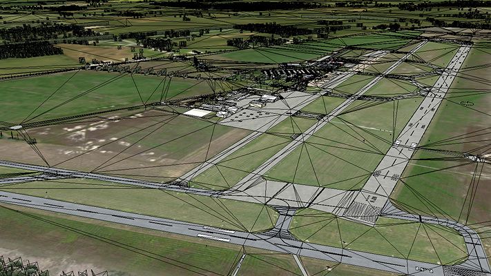
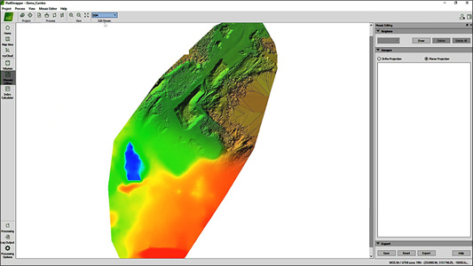
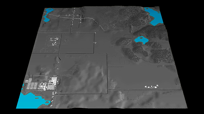
3D mapping, more than just a map!
3D mapping is used to generate digital surface models such as DEM / DSM / DTM elevation maps. In this way, the latter allow a precise analysis of the relief of a land, to calculate different measures, areas or volumes.
For example, it makes it possible to carry out bank erosion monitoring, environmental monitoring during natural disasters, forest fires, climate change as well as to map flood zones.
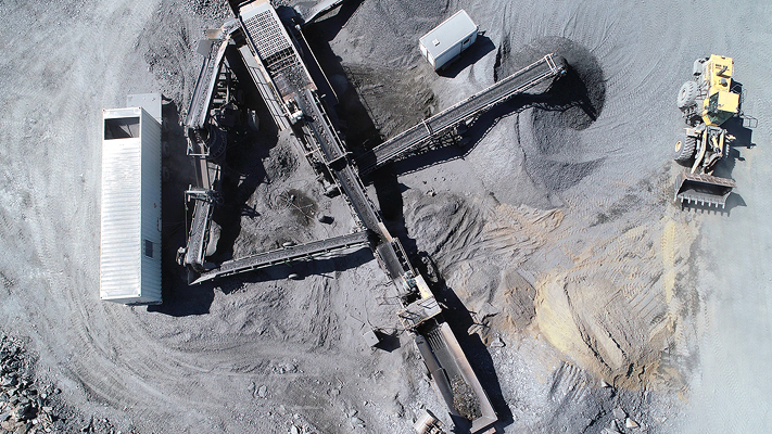
In short, orthophotography mapping is a precise (dated) source of temporal information for monitoring construction sites in construction and mining.
A realistic 3D rendering, based on the acquisition of 3D GIS data in the form of orthophotographs, first meets the needs and problems of each profession: topography, engineering, architecture, construction, real estate, agriculture and forestry.
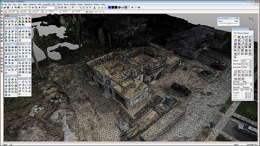
Textured 3D modeling, accomplish more in less time!
S.T.A.N.D. uses 3D GIS data acquisition (drone surveying) to generate 3D models for different types of topographic surveys. In short, the calculation of different measures of areas and volumes or even the inspection of a building is carried out more quickly than with conventional methods.
Photogrammetry thus facilitates inspection by 3D modeling, ideal for viewing and sharing. Large civil construction sites, buildings, works of art, archaeological site and other public infrastructure are just a few examples. We help experts, technicians, architects and engineers to carry out an aerial inspection quickly while minimizing the risks.
3D, an optimized essential
Several 3D data blocks can be assembled later to create a larger virtual database. The georeferenced databases can be viewed by combining different BIM models (eg Revit, Navisworks, Civil 3D…) for a 3D or 4D simulation, an interactive real-time visualization integrated in a 3D engine, an augmented reality application or finally in a video presentation.
Different export formats are available to you for greater flexibility and allow the exploitation of data with the most popular software: Autodesk, etc …
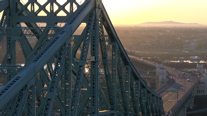
Technical inspection by drone, a new angle to close the loop
At first glance, whether for time tracking, security, maintenance, inspection or monitoring of construction sites, acquiring 3D GIS data by drone (drone surveying) is safe and fast.
It now avoids the intervention of more expensive means such as scaffolding, crane, nacelle or others. The drone will then provide a quick and precise visual inspection for infrastructure, roofs and building facades, exterior and interior sites difficult to access and complex structures such as bridges, viaduct, dams, etc.
When it comes to thermal imaging cameras, our images are able to illuminate beyond what the eye sees. This allows you to see anomalies and thermal bridges, infiltrations or heat sources. The insulation of a building envelope and the condition of the solar panels can also be analyzed.
Opt for S.T.A.N.D. Technologigies solutions and discover the operational gains that 3D data will bring you!
Construction and
Civil Engineering
Transport
industry
Mining
industry
Energy
industry
Agriculture
and forestry
Tele
communication
Municipality and
Town Planning
Real estate and
Public services
Aerospace and
Public Safety
Post-disaster assessment
Environment
sector
Cultural
industry